
Glenview ZIP Directory Coverage
Official sources verified two Glenview postal labels with a realignment history and one additional processing-label relationship. That is not the same as three municipal ZIPs. Use the USPS ZIP Code Lookup for a specific delivery address.
| ZIP Code | Areas Covered | Post Office | Notes |
|---|---|---|---|
| 60025 | Historic and current Glenview-area label in older sources | USPS bulletin and archive | 2004 realignment changed delivery last lines |
| 60026 | Primary current Glenview last line verified by USPS | Glenview Post Office | Postal label, not a village boundary |
| 60093 | Grouped with 60025 and 60026 for processing | USPS FAST label list | Not verified as a Glenview municipal ZIP |
No other ZIP was verified for incorporated Glenview in the source sweep. That careful limit matters. A processing group routes mail efficiently but does not define where the Village governs, where a parcel lies, or who receives mail at an address.
Glenview ZIP Change in 2004
A USPS Postal Bulletin made the local quirk precise. Effective July 1, 2004, USPS realigned Glenview ZIP boundaries and directed the use of Glenview, Illinois 60026 as the last line for deliveries that had been in 60025. Historical directories should retain the ZIP printed at the time.
The current USPS FAST label list groups 60025, 60026, and 60093 beneath a Glenview processing label.
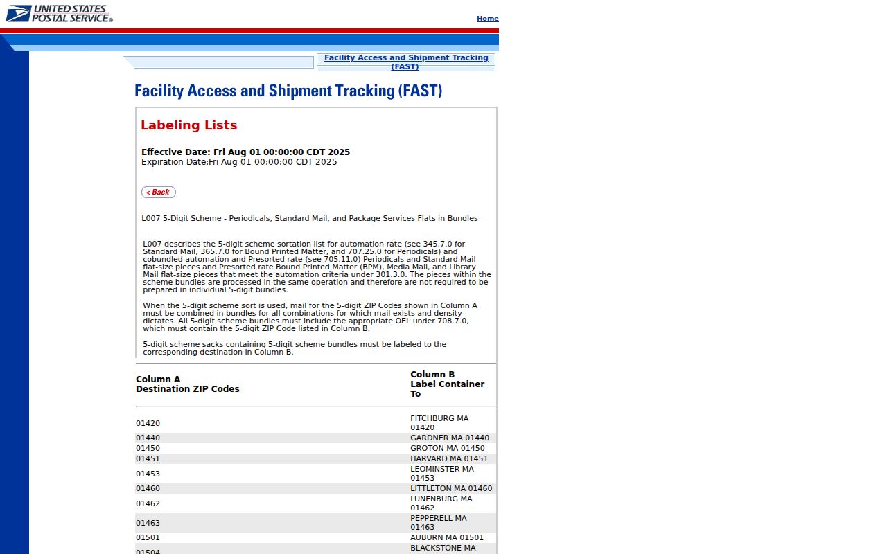
The image documents mail processing, not municipal coverage. It is especially useful when a 60093 result appears near Glenview and needs a more exact check.
Search Glenview Postal Fields
The postal lookup offers three routes. Choose the one that matches the fact in hand, and copy the standardized output without assuming occupancy.
| USPS mode | Fields | Best use |
|---|---|---|
| By Address | Company optional; street; unit; city; state; ZIP optional | Normalize one delivery address |
| By City and State | City and state | See postal ZIP choices for a city label |
| Cities by ZIP | Five-digit ZIP | Read accepted postal city names |
USPS output proves postal formatting only. It does not show a household, ownership, or municipal jurisdiction.
Find Glenview Records by ZIP
A ZIP code directory narrows geography before a record search. It does not produce a public resident roster. The county Property Information search accepts an optional five-digit ZIP with an address. CookViewer and the parcel REST layer carry ZIP attributes. Illinois voter lookup requires a ZIP but is self-verification, not a way to browse other voters.
- Normalize the full street and unit through USPS and save the returned last line.
- Enter the address and optional ZIP in Cook County Property Information, then note situs and mailing fields separately.
- Compare the parcel in CookViewer with the county ZIP layer and Glenview's Census place boundary.
- Use the Illinois voter portal only to check your own registration with name, birth date, ZIP, and street fields.
Once the correct postal area and parcel are known, the Glenview street directory workflow handles street-level research. For a failed online search, contact USPS, county GIS, the Assessor, or Village Hall. A targeted public-record request can seek an unpublished municipal addressing history, while library directories preserve older usage.
Map Glenview ZIP Geography
The Cook County ZIP boundary layer supports map selection, queries, and statistics, with a displayed 2,000-record maximum. It is a county GIS approximation to postal geography.
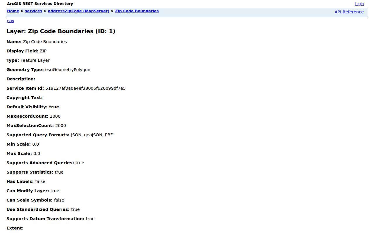
Compare this layer with USPS for delivery and the Census map for incorporation. No one map settles all three questions.
The official Census boundary PDF presents Glenview's incorporated-place boundary in three sheets for the 2024 and 2025 boundary program. School, park, library, fire, township, parcel, and ZIP lines may all diverge, even when an address is casually called Glenview.
Glenview Post Office Check
The Glenview Post Office page lists 1400 Patriot Boulevard, Glenview, IL 60026-7702, phone 847-832-4693. Posted retail hours are Monday through Friday, 8 a.m. to 6 p.m., and Saturday, 8 a.m. to 1 p.m.; Sunday is closed.
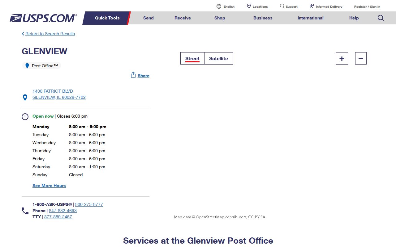
The office is a phone or in-person fallback for delivery questions. County offices remain the source for parcel, tax, deed, and municipal-line questions.
Glenview ZIPs Versus Village Limits
Postal service, local government, and land records draw boundaries for different purposes. A Glenview last line may not place a parcel inside the incorporated Village. A tax-bill mailing address may be far from the physical site. A historical directory can show 60025 while current USPS formatting returns 60026. The right result is a dated comparison, not a forced match.
- ZIP and ZIP+4
- The five-digit delivery area and an added four digits that narrow sorting to a smaller delivery segment.
- PO-box ZIP
- A code used for post-office boxes rather than a broad street-delivery area.
- Unique ZIP
- A code assigned to one high-volume organization. None was verified for Glenview in this research.
- Carrier route
- A postal delivery path within a ZIP, not a neighborhood or legal boundary.
Use lawful, personal purposes only. ZIP-keyed results can be stale or attach to the wrong side of a border. Confirm the address with the office that owns the relevant record.
Compare Glenview Address Labels
A disciplined ZIP code lookup keeps each label separate. The situs is the physical parcel location used by assessment and GIS systems. The tax-bill mailing address is where correspondence goes. The legal description identifies land by section, township, range, subdivision, lot, block, or related PIN. Historical directories preserve the publisher's dated form.
| Postal source | USPS delivery last line and ZIP+4 |
|---|---|
| Parcel source | Assessor, Property Information, and CookViewer situs |
| Government line | Census incorporated place and Village records |
| Past usage | Telephone books, maps, newspapers, and local archives |
Cook County PINs appear as five dashed groups, such as 04-22-304-011-0000, or as 14 digits. A PIN can link property systems when a postal address changes, but its parts should not be read as a street code.
Write down four dates when comparing a difficult Glenview address: the date of the USPS check, the parcel tax year, the date of the county map layer, and the year printed in the historical directory. A current postal result should not silently replace an older directory line. Likewise, a county parcel ZIP attribute may reflect the map's maintenance cycle rather than the latest delivery edit. Keeping dates beside the labels makes a disagreement useful instead of confusing.
District layers provide another check. CookViewer can display municipality, township, school, park, library, fire, zoning, and elected districts. The GIS Consortium service finder can also return services tied to an address. Those layers explain how a place can use a Glenview postal line, fall within New Trier Township context, and still require a separate test for Village incorporation. None of the layers identifies a resident by itself.
When Glenview ZIP Search Fails
First remove assumptions, not data. Re-enter the full address in USPS with the unit separated, then try the standardized street in county Property Information. If several parcels appear, use the map and PIN rather than choosing the first row. Search a deed by legal description when a modern street term does not match older recorded language.
Phone or visit the Glenview Post Office for a delivery-line question. Contact county GIS at gis@cookcountyil.gov for the ZIP layer and clerk.maps@cookcountyil.gov for map or Clerk help. Village Hall is the better route for municipal addressing and boundary questions. The Assessor and Cook County Clerk handle parcel and recording issues. If the history is not published, submit a narrow request for the address assignment or change, with a date range and exact street.
Libraries add the historical channel. Telephone directories, atlases, newspaper notices, and local maps show how an address was printed at a past date. No official Glenview-wide renumbering manual or complete online Sanborn viewer was confirmed, so the absence of an online hit should be recorded as a gap. It should never be filled from an unsourced people-search listing.
A mismatch should be sent to the office that controls the disputed label. USPS controls delivery formatting and ZIP assignment. Cook County GIS maintains the county map layer, while the Assessor and property portal maintain parcel and tax fields. The Village handles municipal addresses and incorporated boundaries. Census boundary maps serve a separate statistical purpose. Save the query, result, and check date from each source, since live portals and postal labels can change after publication.
Historical research needs one more step. Preserve the ZIP printed in a telephone book or newspaper, even when USPS now returns another code. Label that value with the publication year, then add the current standardized result beside it. The documented shift from 60025 to 60026 is useful evidence of change, not permission to modernize an old citation. This dated comparison keeps a Glenview ZIP code directory accurate across both postal eras.